
Walk a Baton Rouge Street
Use the address as a route through several custodians, not as a claim about who lives there. The EBRGIS Property Lookup establishes the lot ID, standardized situs address, subdivision, ZIP, jurisdiction, and district context. “Situs” means the physical location of the parcel. The East Baton Rouge Parish Assessor then supplies the assessment and tax-owner layer. Recorded conveyances at the Clerk of Court show how legal ownership changed, while the voter portal and dated directories may associate people with the same address.
- Normalize the street number and name in EBRGIS, then record the jurisdiction and lot ID.
- Open the Assessor route and compare the situs address, owner record, and tax mailing address.
- Use the legal description and owner name in the Clerk’s conveyance index, then follow earlier transfers.
- Check the Louisiana voter address form for an exact address, subject to protected-voter rules.
- For an older snapshot, search a reverse directory under both current and former street names.
This sequence separates location, ownership, and occupancy. A mailing address may belong somewhere else. A deed names parties to a transfer, not everyone in the household. For year-by-year editions, use the Baton Rouge city directory collections.
Normalize Baton Rouge Street Names
Street spelling is a local search issue. The City-Parish Street and Subdivision List is updated weekly and helps confirm the official form. EBRGIS search tips retain SAINT in names such as SAINT LOUIS and SAINT FERDINAND. Numbered streets use ordinal abbreviations, while directional prefixes and suffixes may be optional. Wildcards can help when the full spelling is uncertain.
Next, run the EBRGIS jurisdiction lookup. The parish includes Baton Rouge, Baker, Central, Zachary, and unincorporated areas. Postal city names and ZIP codes do not settle the municipal boundary. Saving the municipality, subdivision, lot, and ZIP at the outset prevents records from two places with similar street names from being mixed.
Note: Keep the exact spelling returned by the custodian beside every variant used in the search.
Search Baton Rouge Addresses in EBRGIS
The public EBRGIS screen offers several paths into the street directory. Its inspected form supports address, subdivision, business, NAICS code, and lot-ID searches. Downloadable property information also helps when a named street has many address points. This is a parish-wide spatial index, so it can reveal separate lots, business records, and subdivisions that share part of an address.
| Search route | Input | Best use | Limit |
|---|---|---|---|
| Address | Street number and name | Find one situs point | Spelling must be normalized |
| Subdivision | Subdivision name | Separate repeated street names | Not a resident list |
| Business | Business name | Locate a business record | Does not prove a household |
| NAICS | Industry code | Group business uses | Commercial context only |
| Lot ID | EBRGIS identifier | Return to an exact detail | Not a deed number |
The official EBRGIS search screen displays those routes.
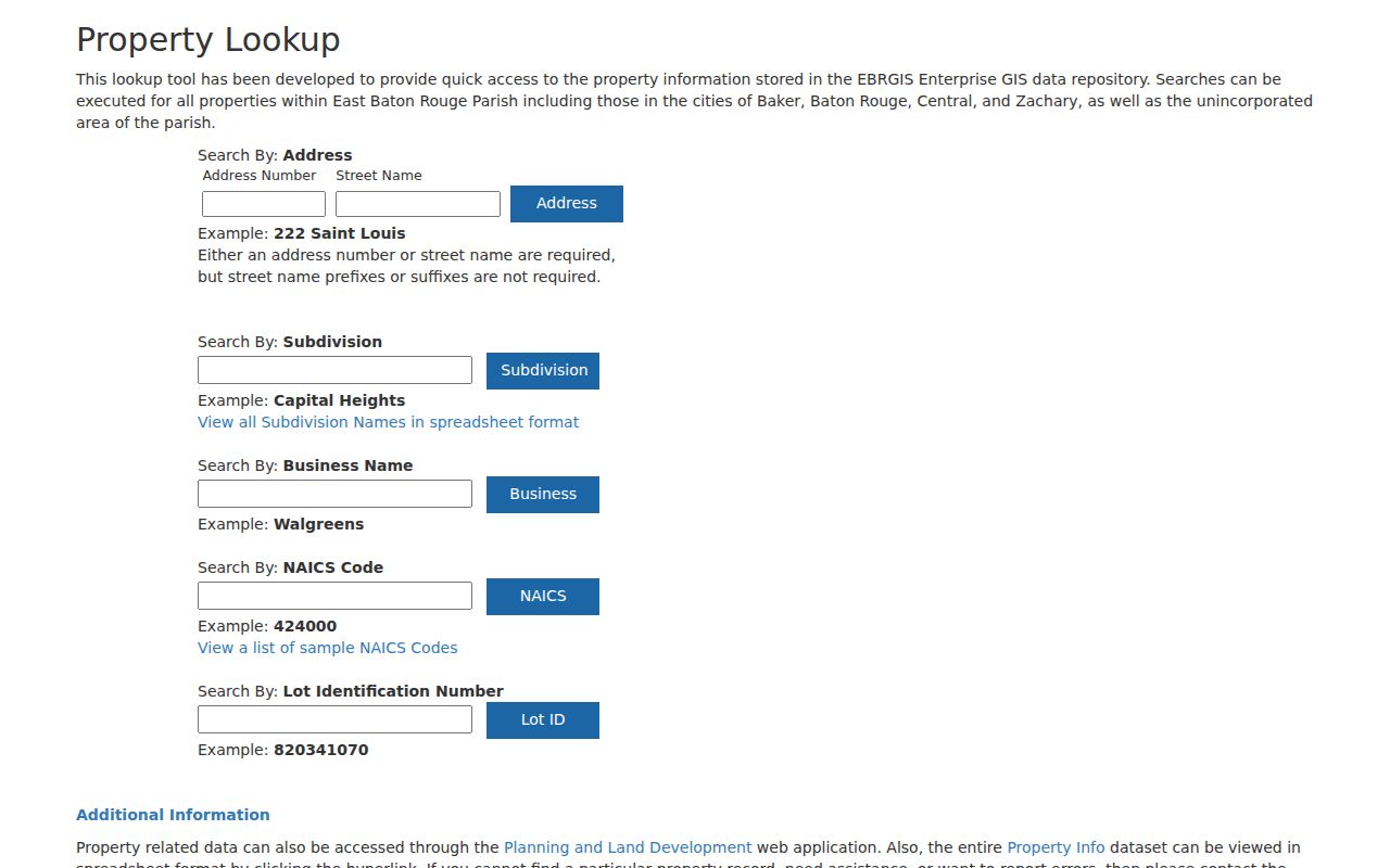
The capture makes the split between address, subdivision, business, and lot searches clear. Treat each as a different key into the same geographic system.
Read Baton Rouge Parcel Context
An EBRGIS detail can return far more than a pin. The inspected 7711 Goodwood Boulevard example includes lot ID, ZIP, subdivision, acreage, zoning, character area, land use, census tract, jurisdiction, council and school districts, police and fire districts, voting precinct, legislative districts, services, and neighborhood. Those fields describe civic and land context. The same record did not expose a tax owner or mailing address.
The official parcel-detail sample shows the fields available for one Baton Rouge address.
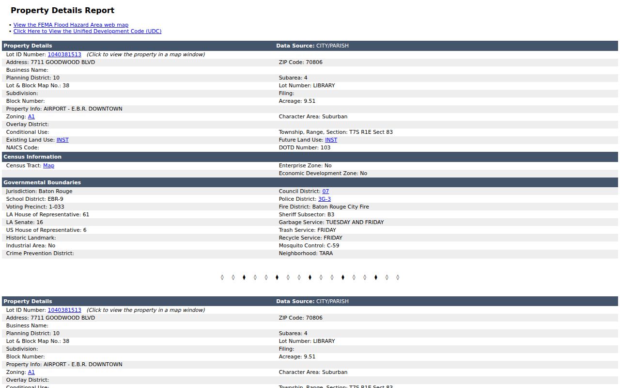
The page can be printed or saved as CSV. Its lot ID returns to the mapped feature, but ownership belongs with the Assessor and legal title with the Clerk.
- Parcel
- A mapped unit of land used for tax and land records.
- Situs address
- The parcel’s physical address, which may differ from the owner’s mailing address.
- Plat
- A recorded map identifying lots, blocks, streets, and subdivision boundaries.
- Criss-cross directory
- A dated directory arranged by address or phone rather than only by surname.
Baton Rouge Records by Street
Each address-keyed source answers a narrow question. The street directory becomes reliable only when those answers are labeled and compared. Current GIS context is not an owner card. An owner card is not a roster of occupants. A permit can name an applicant, contractor, or owner without identifying a resident.
| Address record | Custodian | What it establishes | Access |
|---|---|---|---|
| GIS detail | EBRGIS | Lot, address, ZIP, zoning, districts | Free web search and CSV |
| Assessment | EBR Parish Assessor | Tax owner and assessment context | Portal or office |
| Conveyance | EBR Parish Clerk | Vendor, vendee, instrument, legal description | Subscription or free inspection |
| Voter address | Louisiana SOS | Voters returned for one address | Public form with limits |
| Permit | City-Parish Development | Project, applicant, and work trail | MGO and department |
| Reverse directory | EBRPL | Dated occupant association | Library or database |
Three matching sources strengthen an address finding. Conflicts should stay visible because dates, legal roles, and update cycles differ.
Separate Baton Rouge Owner Records
The East Baton Rouge Parish Assessor maintains the ownership and assessment function. Its site advertises SmartCAMA and directs users to the GeoPortal, but public SmartCAMA fields were not stable during research. The main office is at 222 St. Louis Street, Room 126, with Coursey and Central branches. The published phone is 225-389-3920.
Assessor guidance says the owner of record on January 1 receives the tax bill. A transfer recorded with the Clerk is reviewed by the Assessor. Tax mailing addresses can differ from situs addresses, so neither alone proves residence. Homestead status can support an owner-occupancy claim, but it does not identify every person present.
The Assessor GeoPortal capture displays Feature Data, export, print size, orientation, map title, and result controls.
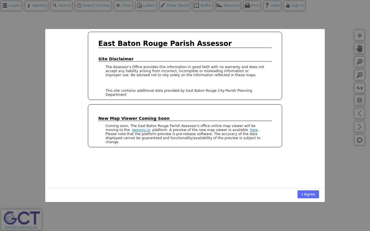
The viewer warns that data may change and should not be the sole basis for decisions. Confirm key ownership facts with the tax card or deed.
Follow Baton Rouge Deeds by Street
The Clerk Recording Department records notarial acts and assigns each a stamp and ORIGINAL AND BUNDLE number. Louisiana labels matter: conveyances run through Vendee/Vendor indexes, while mortgages use Mortgagee/Mortgagor indexes. A vendee receives property; a vendor transfers it. Mortgages, liens, releases, and judgments are not sales.
ClerkConnect offers subscription land-record search and printing. Research did not establish an online cutoff or expose public fields. Regular-hour inspection at the Clerk is free. Copies generally cost $1 per page, certification costs $10, and map copies cost $3. Call Recording at 225-389-3985. Older parish material routes to Archives at 444 St. Louis Street.
Counter advantage. A legal description, lot, and subdivision can distinguish parcels when a Baton Rouge street number changed or a name has variants.
Add Baton Rouge Permit Dates
The City-Parish Development Department routes permits, inspections, and code matters. MGO Connect documentation supports searches by permit number, address, or name, though the portal can require an account and phone activation. Add each permit date and project type to the address timeline, then label the named party’s role.
A permit applicant may be an owner, contractor, designer, or agent. The record supports building chronology, not occupancy. EBRGIS metadata says its address layer draws from plats, permits, E-911 MSAG, the Polk City Directory, and field collection. This local mix explains why the map normalizes addresses while ownership stays with separate custodians.
Check Baton Rouge Voters by Address
The Louisiana voter address search uses ZIP Code, Address, Apt/Lot, and City. It returns voters linked to one entered address, not a free browse of a whole street. Repeat exact addresses only for a lawful personal reason, and save the date of each result.
Louisiana R.S. 18:154 limits voter information. The Address Confidentiality Program can substitute a protected address. A null result may mean the person is not registered there, the entry differs, or the address is protected. It does not prove a home is empty.
Bridge Baton Rouge Street Changes
The official street-name-change file records former names, replacements, subdivisions, and dates, including changes from 1942. EBRGIS annexation metadata depicts city growth from 1817 and individual annexations since 1949. Search both names, plus subdivision, lot, block, and parish.
This connects old deeds and directory editions to current parcels without forcing a false match. It also explains why a Baton Rouge postal label may persist while jurisdiction changes. Early records may use colonial, territorial, parish, or city descriptions instead of a modern address.
Note: Date every historic directory match because an address-to-name link belongs to one edition, not the present.
Baton Rouge Street Directory Limits
A public street directory cannot supply a full household list. GIS shows land context. The tax roll shows an assessed owner. Deeds document legal acts. Voter results are limited, and reverse directories record one edition. Renters, relatives, guests, and recent movers may be absent. Utility and motor-vehicle addresses are not public household substitutes.
The custodian’s own record date is vital. EBRGIS does not show a parcel-history date on the inspected detail, and its map warns that the data may change. The Assessor works from an assessment cycle, while a Clerk instrument has its own execution and recording dates. Voter and directory evidence also belongs to a distinct date. Put those dates in separate columns rather than collapsing them into one answer about who lives there now.
Some records also describe roles rather than residence. The named person on a permit may be a contractor or agent. A deed party may have signed for an estate or business. A tax mailing address can be the place where an owner receives notices. District, precinct, zoning, and neighborhood fields locate the parcel in civic geography, but they do not identify a household. These distinctions keep the Baton Rouge street directory from overstating a useful clue.
If the web route fails, preserve the failed URL and move to the documented access channel. The Assessor has a downtown office plus Coursey and Central branches. The Clerk permits free regular-hour inspection, sells copies, and routes old instruments to Archives. EBRPL Special Collections and its genealogy databases provide the directory and map fallback. A focused phone, counter, or archive request should state the address, former name, subdivision, lot, parties, and date range.
Finally, current record gaps must remain gaps. SmartCAMA fields were not exposed in the research inspection, ClerkConnect did not reveal its query fields without access, and no official source supplied a single online deed-index cutoff. Those limits should prompt direct verification, not guessed fields or years. The street directory is strongest when each result names its keeper, date, access method, and exact claim.
Use these records for family history, property research, civic curiosity, or transaction checks. Mark uncertain links and contact the custodian when a certified copy matters.
Lawful use. Baton Rouge address records are for lawful personal research. Never use them to stalk, harass, intimidate, or harm anyone.